Lessons in chalk modeling: The new method of map drawing — Text and Context
Edition facts
For Lessons in chalk modeling: The new method of map drawing — Text and Context, the stored edition analysis reports 25,835 words, 1 hr 53 min estimated reading time, and 25 detected text sections.
The text analysis averages about 19.4 words per sentence, while the detected sections provide another way to judge how the source is divided.
Project Gutenberg metadata also associates the work with “Geography -- Study and teaching,” connecting these edition facts with the source record’s subject description.
Calculated from edition completeness, EPUB availability, text structure and catalogue metadata. Not a user rating.
How this score is calculated
- Description quality20 pts
- Title & short description10 pts
- Source metadata20 pts
- Text length15 pts
- Chapters / structure15 pts
- EPUB file integrity20 pts
Total of 100 points, scaled to a 2.5-5.0 range. Editions with an empty description or a missing EPUB file are not scored.
Read the Text
ter some snow-storm? Tiny seeds in the corners where the winds have left them; insects in the spring;—where did they come from? Where were they all winter? These and many other hints might be given for such study.
_The country_ furnishes a rich field for investigation. Around every building and in many localities that can be easily reached, most of the types of the earth’s surface forms may be found. Care must be taken that they are considered as _types_, or the pupil might answer the question, “How high are mountains?” as the child did who said in reply, “Two inches high.”
In the lower grades of school, much of the geography work should be the direct lesson in the field followed by lessons in school. The higher grades, also, should continue the frequent field excursions which are begun in the lower.
Visits may be made to the hills, groves, lakes and ponds of the vicinity, and upon returning to the school-room, these and surrounding areas may be modeled in sand or clay, painted in water-color or drawn on the blackboard.
Brook basins may be studied as presenting many if not all of the features of the river basins. Maps may also be made of these areas, as well as detailed drawings of special features.
As has been said, the pupil should model and draw continually, in connection with or after every lesson in the field. It is the very best method by which to attain mental growth, and should of course, be the genuine expression of his own mental images gained through observation. He should model and draw all surface features or areas seen in his excursions. He may model, in sand, putty or clay, maps of the areas of the school-yard, farms or parks in the vicinity; or chalk model them, then indicate upon them the boundaries of any sub-divisions they may have, such as fields, clumps of trees, houses or other buildings.
_Imaginary Areas._ Let the pupil also sketch on the blackboard, imaginary scenes and typical features of other areas and countries under the same or contrasting climatic and other conditions; always questioning, as he draws his mental picture—if of a river, for instance—what is the cause of its rapidity, what its probable depth and effect on the soil, why it cuts here or builds there, and why the slopes back of it are terraced as they are.
If he represents islands, he should ask himself the question why they are rocky or alluvial; _i.e._, what their origin; and never represent in any expression that which is contradictory and so untrue to nature.
Landscapes typical of the different zones of temperature, showing characteristic structure, vegetation, homes, habits and occupations of inhabitants may be drawn.
Maps, also, of these areas and those adjoining, may be chalk modeled. As the mind becomes stored with separate images acquired through actual observation of areas of the earth’s surface, gradually, by the combining and blending of these, a new mental image, a comprehensive picture is formed, corresponding in the main to the general features of the whole earth, with its uplifted masses and lower plains, its natural divisions of continents, seas and oceans, its atmospheric and climatic conditions.
If the habit has been formed of chalk modeling imaginary areas, as well as those within the sense grasp, it will be a comparatively easy matter to chalk model a map of the whole continent. On this the student may mark the boundaries of all political divisions as he studies them, and locate the important cities and places of interest.
_Practical Suggestions._ Before we leave the subject of field lessons, some practical suggestions in regard to them are here offered.
Actual observations may be made on the action and effects of rivers, underground water, rain, wind, heat and frost.
The effects of glacial action, and the eruptive forces of nature may also be seen in places.
To study river action it is not necessary to visit a river (if there be none near); any small stream of water, any tiny rivulet beside the roadway, tells its story of wearing and building, its vertical cutting and its swinging from side to side. It has its miniature valley, its basin and water-parting and possibly a delta at its mouth. It may also have its cascade or waterfall.
The wearing of rock, through the influence of rain, frost and heat, may be seen in any stone building, fence or pavement.
Effects of heat and moisture on vegetation, as influencing the growth of plants and trees, should be noticed. The growth of shrubs and trees during a dry season can be measured and compared with that of wet seasons.
The observer should mark the effect of vegetation in the action of rain on a grassy slope—how the grass protects the soil, preventing it from being washed away, and how, by holding back the water so that it flows more slowly, it is less destructive in its action.
To add to the interest, the pupil may be led to imagine the effects upon climate and streams, of the denuding of large areas of their forests; also how rock sculpturing, in the forming of gorges, cañons, etc., would be modified by the volume and force of streams.
Observation should also be made on the making of soils, their constituents and relative proportions of loam, sand, gravel and clay, and the relation of these to plant and animal life.
The part that the common earth-worm bears in constantly uniting, enriching and otherwise preparing the soils for the support of vegetable life, may be seen in many areas. (It has been computed that in one year several tons of soil are brought up and distributed by them, within an area of an acre of land.)
A study made of the action of underground water, as shown in common and intermittent springs, would be full of interesting suggestions.
The effect of glaciers may be seen in part and their tremendous influence imagined, by the presence of the countless numbers of striated boulders, pieces of rock and pebbles, which are strewn all over our prairies hundreds of miles from any mountains which could have been their home.
It is not necessary to witness the devastation of a cyclone in order to study the effects of wind action. The piling of sand on the sea-shore, the drifting of snow or the whirling of dust in the street illustrate this. The observer may notice where the dust blown from the street has choked and buried the grasses and weeds beside it, and imagine what might be the fate of forests in the path of encroaching sand-dunes.
Pupils may be told of the dunes which travel great distances: that one way by which this is known is by noting trees and houses that were once back of the traveling sand-hills and are now in front of them; also tell of the sites of ancient cities long buried and now being excavated and brought to light again.
IMPORTANCE OF LEARNING TO INTERPRET PICTURES AS AN AID TO IMAGING THE CONTINENT.
The ability to image the continent or any part of it, from the reading of pictures, is of great importance. It is an inexpressible aid to the imagination in the study of areas that lie outside of the sense grasp. Good pictures should be chosen: pictures showing several different views of the same section of a country; pictures that are a truthful representation of both detail and generalities. (Many wood cuts are as good as photographs for this purpose. Great care, however, should be taken that they are faithful transcripts.)
After a close study of them, questions may be asked the pupil as to climate, structure, nature of rock and soil; whether it may be supposed to be an arid or fertile region; whether the river basins are young or old; what agents were most active in shaping its features, and what its probable destiny: or the pupil may be led to give his own inferences as to conditions, without direct questioning.
In this way contrasting sections of country may be studied and compared, thus making the mental picture more vivid and complete.
It is understood that these mental images gained from such study of pictures, have as a basis, images acquired from actual observation of the earth’s surface. From this mental picture, supplemented by images gained by oral and written descriptions, maps may be chalk modeled which will contain all the essential features of structure.
Valuable information for the making of maps has been gained in this way; indeed, adequate maps cannot be made without this means of acquiring the necessary knowledge, which the delineator has not been able to gain through travel and personal investigation.
Through this study or reading of pictures a natural interest is aroused in the mind of the pupil to see located on the map (that is, to see in relation to the whole) countries and places of special interest; such as natural wonders of structure, and remarkable instances of man’s skill and power in overcoming obstacles and improving his environment.
Especially will this be the case if the teacher accompanies the descriptions with rapid illustrations on the blackboard.
Necessity for skill in drawing on the part of the teacher, becomes very evident as the desirability of frequent illustrations is felt, and the fact is also realized that by it untold influence for good is exerted over the mind of the pupil. It is an aid to correct mental picturing, which the teacher cannot afford to omit.
Special features are more readily understood when drawn in detail: as mountain peaks, stern or forbidding in outline, or lofty and grand in their mantles of snow and rivers of ice (Mt. Blanc); valleys with wooded slopes and streams of water; lakes, waterfalls (Niagara Falls); glaciers and icebergs, with typical scenes of Arctic regions, including inhabitants with their homes (Muir Glaciers), (Alaskan huts and totem-poles); deserts and oases, with typical trees and surrounding objects (palm trees, pyramids, camels); Indian homes and environment; dykes of Holland, Suez Canal, St. Gothard Tunnel, Great Wall of China, etc.
MAPS OF THE PAST AND PRESENT.
As it is impossible to adequately teach the surface features of a country with only a vague idea of its structure, and with no aids in the form of pictures, drawing or modelings by which these surface features may be illustrated, there arises the necessity for maps.
These, to be of any real service, must be a representation of the form and character of the area which is the subject of study, and must indicate the relation of part to part, parts to the whole, and the whole to parts.
As symbols and more than symbols, they must bring to the mind vivid pictures of the real country or continent, not as too commonly taught; “A mental picture of the map, so clear and consistent ... that he (the pupil) can read the answers to all questions concerning it, from his mental map, as easily as he could from the printed one, if it were before him.”
This is to limit and cramp the mind’s action, as the pupil sees only the map and its corresponding concept of map, its size, boundaries and patches of colored paper. It gives no idea of relation or correspondence between the map and the actual world of life, form and color.
_Aim of Teacher._ In using maps it should be the aim of teachers to create in the mind a complete, harmonious picture; the blending together of the several concepts of structure, climate, drainage, soil, vegetation, animal life, races of men, etc., corresponding to reality, or real life in the real world.
_The flat political maps_ of the past made no attempt to show any structural features except those of horizontal or level plains, markings which show the locations of mountain ranges and volcanoes, and lines indicating rivers and outlines of continents or coasts.
These maps have had comparatively little meaning to the young pupil. There was in them no suggestion of solidity or mass; the contents to him seemed flat and thin, and confined between coasts which were sharply defined. Tent-like mountains crossed ghost-like surfaces, and thread-like rivers were made to zigzag along in an erratic and irresponsible way, showing to him no reason whatever for their being.
Many teachers or pupils have not known how to interpret maps. They have not realized that, where rivers rise in certain localities (especially if more than one rises in the same place), there is a reason for their rising just there and for their flowing in different directions; that their source is probably at an elevation or rise of land (called a divide or water-parting), that there is likely to be more rainfall on the side of the mountain range that has the more rivers, and that this has a close relation to the direction of the prevailing winds.
_Natural Boundaries._ In the past study of these maps, outlines of political divisions have been memorized. It was not realized that many of the boundaries of those areas were fixed in the beginning by the very nature of the surface structure, and that they are where they are, simply because they could not well be anywhere else. (See Mexico, India, Italy.)
_History._ We have seen that the study of history cannot be successfully taught without a knowledge of structural geography on the part of teacher and pupil; so we may say the same of maps, that their use is of fundamental importance in that study, and the ability to read them understandingly is as indispensable as it is in the study of geography. To try to teach history otherwise would be a waste of time and effort.
The habit of locating the events recorded, of tracing upon the map the route of an army, or the line of an important road or canal, and observing the impediments or natural obstructions to be overcome, with the great advantages to be derived therefrom, together with inferences as to the time and labor required, has the effect of making the study of history of living interest, especially if the map used indicates such surface structure.
In the structural map the student readily sees the meaning to commerce of the cutting of a canal which would unite two large bodies of water, or the effect the building of roads and bridges across hitherto impassable regions would have upon the life and growth of a people in the opening up of new and extensive areas to civilization, and consequently the development of their own internal resources.
The importance of this habit of usage, or constant reference to the map, is also recognized when one realizes how it fixes in the memory not only the location of cities and boundaries of ancient empires, but the geographical structure and environment associated with their growth and with important historic events; making plain the reasons for, or causes why, certain events occurred at certain places, as the inevitable consequence of their environment.
Light dawns upon the pupil as he studies. He sees that environment has been an important factor in the development of the human race. He traces step by step in imagination the growth of civilization, from the time that man in his nomad stage first drove his herds into the valley in search of food and water. There, finding the soil productive, water unfailing in supply, and the valley protected from marauders by natural barriers, as desert or mountain walls, he fixes his home; in the course of time comfortable dwellings are constructed, land is cultivated and the place becomes a center of civilization.
In connection with this train of thought, the student by contrast notes the far different effects of environment as shown by life in the Arctic or other regions, and he turns to his map with renewed interest and eager inquiry.
_Literature._ The habit also of locating on the map every place, natural feature or country read about, should be cultivated, as it is of importance in obtaining a correct understanding of an author’s meaning.
If we did not have the knowledge of physical structure in mind as a stage on which the actors move, much of our literature would lose its value, becoming flat and uninteresting.
To know the great lake region adds to one’s interest in Longfellow’s “Hiawatha,” and the tales of the early explorers; and a knowledge of the Catskills and the geography of the Hudson River valley gives greater zest to the enjoyment of Irving’s “Rip Van Winkle” and “Sleepy Hollow.”
It is also necessary to the understanding of the stories of Holland (“Hans Brinker”) that we know the habits of the Hollanders arising from the physical characteristics of their environment.
To read intelligently Scott, Dickens, George Elliot and others is to understand the peculiarities of climate and structure of the British Isles. The old Greek stories and the German Folk Lore as well, demand for their understanding and interpretation, that we place them not only in relation to the habits and thoughts of the people, but also to the physical foundation of the country itself.
_Relief Map._ The nearer a map corresponds in its inherent form and material, to the surface features of the earth which it is designed to represent, the more of reality does it recall to the mind. The most effective map of this kind and the one which corresponds most closely to the reality is the modeled map of putty or plaster, showing structure in relief.
These maps have been in use for years, and have been of incalculable interest and benefit to those whose stock of knowledge concerning geographical structure had been mainly gathered from the flat political map and old modes of teaching.
On seeing a relief map of one of the continents for the first time, there arises a sense of wonder and surprise, and as the realization dawns upon one of the continuity of the great mass of land represented, with its altitudes and depressions, and that it is one stupendous aggregation of soil, rock and vegetation, surrounded by a great expanse of water, a feeling of awe and astonishment is awakened.
As this new light comes to the student, he looks with interest and eagerness to see the plan of it all. We do not mean to say that he sees in the map before him an actual correspondence to the earth’s surface structure, that is, forms that are reproductions in miniature of mountain range and valley, but he sees a representation of them calculated to arouse his imagination to a lively degree. He is enabled to picture to himself great slopes crowned by lofty mountain peaks, and the meeting of their lower edges where mighty rivers flow. He sees in imagination how these waters have cut deep channels into the great uplifted masses, how they have torn jagged gashes into their rugged sides as they leaped and tumbled through dark cañons, grinding off rocks that form sediment constantly to be deposited later on upon the plain below. He easily understands that they must act as a source of drainage for wet lands and as channels for the irrigation of dry areas.
In looking upon the great bodies of water, oceans, seas, lakes and gulfs, as represented on the maps, he questions the relation of these waters to the land, their depth and what place they fill in the economy of nature. Indeed, the relief map has an awakening effect, quickening the imagination and stimulating to mental effort—earnest thought.
They are invaluable in their place and have come to stay; yet on account of their weight and general unwieldiness they are not practically as useful as maps which are lighter and more easily handled.
_The papier mache_ maps in relief, although much lighter in weight, are still very bulky if made large enough to be of much practical use as wall maps, since they cannot be folded or reduced in size to facilitate transportation, or removal from room to room.
The best of these, also, are modeled in such low relief that they are better adapted to the use of pupils in the higher than in the lower grades. Other maps of rather recent date are the _typographical_ map and the _contoured_ map. The former shows general altitudes by the use of shades of color, and is of great value to one who can interpret it, but only a confused mass of signs and symbols to the young student, and thus not much more helpful to him than was the old reference map.
In the contoured map, the altitudes are scientifically represented by lines drawn to an exact scale, and such maps are most valuable to students of the higher grades.
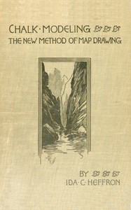
Ida Cassa Heffron's manual repeatedly insists that a clear mental image must precede any attempt at drawing. In the preface she states that with 'a clear mental image of surface forms and areas, the expression of the same will be a simple and easy matter.' This emphasis on visualization before execution shapes the entire instructional method. The book is structured as a series of progressive lessons, moving from simple surfaces to complex continental maps, each step reinforcing the habit of careful observation and deliberate expression.
Heffron's voice is direct and teacherly, often addressing the instructor directly: 'Take the children into your confidence.' She warns against corrections during sketching, which destroy the 'pleasing quality which marks a sketch as “artistic.”' The text is accompanied by numerous illustrations, though the excerpts provide only their captions and descriptions.
The Sequence of Seeing and Drawing
Heffron's lessons follow a deliberate progression from simple to complex. Part I establishes the necessity of structural geography and field lessons, while Part II offers fifteen specific modeling exercises. The first lessons focus on representing surfaces with light and shade, then move to water-partings, lakes, and erosion sketches. Later lessons apply these skills to continents: North America, South America, Eurasia, Africa, and Australia.
This structure mirrors her pedagogical principle: knowledge must be 'arranged in orderly sequence, so logical and clearly defined, that we shall not be obliged to go back and modify or correct any part of our expression.' The sequence itself becomes a teaching tool, building skills incrementally.
Notably, the book includes a lesson on mapping a section of the United States for use in 'preparatory lessons on the Civil War,' suggesting an interdisciplinary application of the mapping method.
Voice and the Teacher's Role
Heffron's prose is consistently instructive and personal. She uses the second person to address the teacher, as in 'Take the children into your confidence.' This direct address creates a sense of shared endeavor. She also reflects on the process of learning to draw: 'When we try to express our knowledge of a subject by drawing, we are often greatly surprised to find how little we know of it.'
The text balances technical instruction with encouragement. Heffron acknowledges that repeated attempts are necessary for progress, and she frames mistakes as opportunities for closer study. Her tone is patient but firm, emphasizing the importance of accurate study before expression.
The excerpts show that she values both observation and imagination. In one lesson, she instructs the reader to draw from an 'imaginary picture' and to 'clear it up, classify its component parts into primary and secondary.' This blend of empirical observation and mental construction is central to her method.
Pace and Density of Instruction
The book's pace varies between dense theoretical passages and concrete, example-driven lessons. The introduction and preface are compact, laying out the rationale in a few pages. The lessons themselves are more varied: some are brief, like Lesson I on surfaces, while others, such as Lesson VI on climate zones, include multiple illustrations and detailed descriptions.
Heffron often clusters related concepts. For instance, in Lesson IV she covers 'Meeting of Land and Water. Lakes. Springs. Islands. High and Low Tide' in a single lesson. This rapid coverage assumes a teacher who can unpack each topic with students. The later continent lessons are more expansive, with North America receiving two lessons (VIII and IX) and Eurasia one with 'Sections in Detail.'
The illustrations are integral to the instruction. The excerpts reference figures showing erosion, rock formations, and scenes from Siberia, the Sahara, and the Amazon. These images serve as both examples and prompts for student observation.
Heffron's manual is best read as a practical companion for teachers, not a theoretical treatise. The lessons assume access to chalk, a blackboard, and the ability to sketch. Readers should approach the book with a willingness to practice the exercises sequentially, as the author intends. The illustrations, though not reproduced in full here, are essential to understanding the method. For modern educators, the book offers a window into early 20th-century progressive pedagogy, where geography, art, and mental discipline converged.
That rainy afternoon, Heffron’s chalk lessons made me see how a landscape forms itself—ridge by ridge, quietly. Her insistence on mental imaging stayed with me long after I closed the book. Later, idly, I found The Education of Children — Story, Setting & Ideas, and it felt like the same patient shaping, only of a child’s inner world.
Scarlett Hall
1 week agoScarlett Ramirez
1 month agoOwen Hill
3 weeks agoCharlotte Harris
1 month agoYour personal reading reflection
Build a private reading journal entry for this title.
Joseph Campbell
2 weeks ago